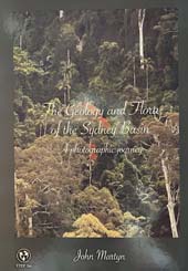
The Geology and Flora of the Sydney Basin
The perfect way to learn about the geology that underpins the landscape and diverse flora of the Sydney Basin
A photographic journey through the rich and varied geology, scenery and flora of the Sydney Basin
The Geology and Flora of the Sydney Basin: A Photographic Journey is an updated and expanded version of Rocks and Trees published in 2018, with a new objective to encapsulate the Sydney Basin to its outer limits.
The book's framework is the basin's geology: the complex succession of sedimentary rocks and the igneous, tectonic and erosional events that affected them across an area that’s roughly twice the size of Wales not to mention two-thirds the size of Tasmania.
On this diverse and extraordinary geology and landscape grow even more diverse and often very beautiful floras. The creation by botanists of formal terms like Blue Mountains Diatreme Moist Forest, Blue Mountains Shale Cap Forest and Shale Sandstone Transition Forest for threatened ecological communities shows a clear recognition of linking the flora to the underlying rocks; thus providing a firm technical basis for a book like this.
A4 portrait format
551 pages
More than 1000 colour photographs plus numerous geological maps, diagrams and sketches
Offset printed, casebound and section sewn so openings lie flat and portray full photograph spans perfectly
Glossary of nearly 300 geological terms with strong bias towards Sydney Basin geology
Appendix of detailed microscope petrography of key rock samples, many with no previously published information – new published data!
135 references
Full index
John Martyn was born in Cornwall and came to Australia in 1970 after mapping in the Rift Valley of Kenya for his PhD in geology. Although he has lived in Sydney since 1979, much of his fieldwork as a minerals exploration geologist over the last 30 years has been in Western Australia.
His first experience of spring in the West Australian goldfields left him stunned by the colour and variety of flowers in the bush. It was the beginning of a lifetime enthusiasm for Australia’s flora and fauna.
Moving to Sydney, John was amazed by the beauty and variety of landscape and habitats around the city’s suburbs. He has been exploring, mapping and photographing Sydney’s natural world ever since.
John joined the STEP committee in 1990 and has dedicated many hours to STEP’s campaigns and publications. John has assisted spreading STEP’s name and aims through the publication of the following books and maps of walking tracks:
- The Geology and Flora of the Sydney Basin: A Photographic Journey (2024)
- Rocks and Trees (2018)
- Understanding the Weather: A Guide for Outdoor Enthusiasts in South-eastern Australia (2013)
- Field Guide to the Bushland of the Lane Cove Valley (2010)
- Field Guide to the Bushland of the Upper Lane Cove Valley (1994, out of print)
- Sydney’s Natural World (2007, out of print)
- Map of Walking Tracks of Middle Harbour Valley and Northern Harbour Foreshore: Sheets 1 and 2 Bungaroo and Roseville Bridge (2004, 2009, 2023)
- Map of Walking Tracks of Middle Harbour Valley and Northern Harbour Foreshore: Sheets 3 and 4 Northbridge and North Harbour (2004, 2020)
- Map of Walking Tracks of the Lane Cove Valley (2000 and 2016)
John has also coordinated our walks and talks programs, with himself leading several very informative and eye-opening walks. In recent years, John has chosen wide-ranging landscapes such as Deep Creek at North Narrabeen, Kurnell and Botany Bay National Park, Dog Pound Creek and the Hornsby Diatreme, Ku-ring-gai Chase National Park at West Head, Cumberland State Forest and Bents Basin. The popularity of his walks for STEP has led John to host walks for Hornsby Shire Council.


