Displaying items by tag: Powerful Owl
Powerful Owl Coalition
Protecting Powerful Owls

Why they need our help
Human actions are causing a decline in numbers through development on bushland fringes, removal of trees and vegetation and road deaths
They are a threatened species — there may be as few as 5000 in the world
Their habitat supports amazing wildlife, enriches our lives and connects us with nature
Future generations deserve to see these birds in the wild
How you can help
Download a flier and give it to your friends and neighbours to read
Download our position paper paper which is designed to educate and encourage all levels of government, professionals, groups, communities and individuals to protect and increase the number of Powerful Owls in urban areas
Make your garden Powerful Owl friendly
Submit sightings to This email address is being protected from spambots. You need JavaScript enabled to view it. (give the time, date, place, any interesting details and, if possible, attach a photo or recording)
Contact your local council and politicians if you become aware of inappropriate development or clearing

This page is hosted by STEP on behalf of the Powerful Owl Coalition
Update on Hills Council Plans for IBM Site
STEP Matters issue 193 provided detail on the application by Mirvac to build 600 apartments in the former IBM business site next to Cumberland State Forest. In addition to the IBM site Mirvac owns a large land area that currently contains high quality bushland.
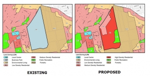
Hills Shire Council applied to the Department of Planning for a Gateway Determination to allow rezoning of the bushland part of the 28 ha site for R4, high density. The department issued the Gateway Determination on 31 October telling the council to do more homework and amend the zoning plan to provide protection of the high value vegetation.
Lo and behold, Hills Council then wrote a letter to the department on 12 December 2017 requesting an amendment to the Gateway Determination to permit zoning of the high quality bushland as E3, Environmental Management. This would allow the area to be subdivided into 2 ha lots with the associated need to bushfire protection zones, roads, water supply, etc all leading to the destruction of endangered ecological community and threatened species habitat.
Mirvac has advised in writing that they want the area zoned as E2, Environment Conservation, and they are not seeking to impose the cost of this protection on the council. So all the community groups opposed to the development are at a loss to understand why council applied for E3.
Council has also applied for special conditions in the DCP for just this site that are different from the rest of the Hills Council LEP. It also requests the removal of the 2.5 ha recreation zone, saying it could create public open space. Why not commit to providing open space that will be essential for the new residents?
They have requested approval for site specific provisions which would enable a single developer, Mirvac, to build a completely ‘new type of housing’ which has been built nowhere else in the Hills Shire, on 86 m2 blocks, in a zoning which provides for 700 m2 lots.
We await the next decision by the department. Go to www.forestindanger.org.au for the latest news and how to make a submission to council or the Department of Planning.
Surprise Proposal to Increase use of Lighting at Canoon Road Netball Complex – Bad for Players and Locals
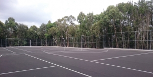
The Plan of Management of the Canoon Netball Complex was amended in 2015. It involved improvements to landscaping and changing the location of some courts and car parks. A consultative committee comprising representatives from the local community, netball players and council officers was to review the operation of the complex and in particular consider the recommendation that lighting be installed to be operated on Thursday and/or Friday evenings between 5 and 7.30 pm for some matches during the winter netball season. The aim was to reduce the problems on Saturdays of traffic movements.
The contentious plan for lighting had not been progressed until in November 2017 Ku-ring-gai Council passed a motion that recommended a change to the Plan of Management so that lighting would be operated on four nights per week on nine courts from 4.30 to 8 pm.
The closing date for submissions was 1 February. Click here for STEP's submission.
Environmental Impact
STEP opposes the plan for any lighting on the grounds of environmental impact. Basically the night lighting does not conform to the objective of the Plan of Management:
… to minimise the impact of Canoon Road Recreation Area upon the adjoining bushland and the Lane Cove River catchment.
The complex is located on a high ridge so that the lighting will spill over the surrounding bushland and Lane Cove River conservation areas. No details are available of the specifications for the lights but they will need to be high and strong to be fit for purpose.
The bushland area is habitat for several threatened species, many of which are nocturnal such as the Powerful Owl. The minimum requirements for large forest owls are that lighting should be directed away from, and not interfere with, nest and breeding roost trees. Diurnal animals may extend their activity well beyond normal sunset but nocturnal animals may be particularly affected due to their eyesight, actual and feared predation, and reduced breeding success.
Traffic Impact
Apart from the environmental issues there are other reasons to oppose the plan. No comprehensive traffic study has been completed that considers the additional traffic that would impinge on the Kissing Point Road/ Comenarra intersection during the busy evening period.
We question whether netball players will want to battle with evening traffic to get to and from Canoon Road. Traffic along the Pacific Highway near Turramurra crawls every afternoon. Surely players and their parents would prefer training to be near where they live. Also it has not been proven that the removal of one age group from the Saturday matches will make a significant difference to Saturday congestion.
Netball is different from other sports in that the playing area is smaller so that there are many more players using a sporting area compared with sports like soccer or baseball. The changeover time between matches involves double the number of car movements. The submission from the Kissing Point Progress Association points out that night matches could generate about 500 car movements per hour to peak hour traffic.
Better Solutions?
Council needs to find a broader solution to the provision of netball facilities. Participation will only increase as our population grows. The concentration of the sport in the narrow isolated location is not satisfactory for such a popular sport. It is not fair to the players and their parents. An effort should be made to find alternative sites for matches and training throughout Ku-ring-gai and Hornsby.
The original plan for the North Turramurra Recreation Area included four lit netball courts but for some unknown reason this has not been implemented. There are plans to upgrade other park areas. The NSW government has plans to upgrade facilities at some schools that could include lighting of courts. Some possible sites could even be accessible by public transport! In theory there are buses that go near the Canoon Road complex but they get stuck in traffic!
Planning Debacle of IBM Site in West Pennant Hills
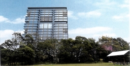
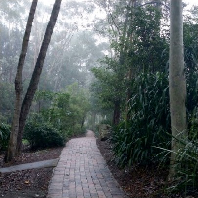 Back in the 1980s IBM built an office complex at 55 Coonara Road, West Pennant Hills. The building design won several architecture awards. The office environment is idyllic. The buildings are surrounded by an extensive tree canopy including Blue Gum High Forest that is now 25 to 30 years old. IBM worked with the National Trust to establish a bush regeneration plan and 40,000 native plants were planted.
IBM sold the land to property developer Mirvac in August 2010. The buildings were renovated in 2011 and IBM is still a tenant but Mirvac has set out to develop the site to take advantage of the site’s location near the Cherrybrook Metro development precinct.
The total site covers about 28 hectares. It is next to Cumberland State Forest. The IBM buildings are on the northern western part of the site. The southern part contains bushland that is at least 70 years old, some having not ever been cleared but may have been logged in the early days as happened in most of Sydney’s original forests. A large part of this area contains critically endangered Blue Gum High Forest or endangered Sydney Turpentine Ironbark Forest. The forest is Powerful Owl habitat plus there is known habitat for the threatened Dural land snail and two vulnerable microbat species. There hasn’t been a full ecological assessment of the whole site.
Mirvac originally proposed to build 1269 dwellings in the area of the old IBM buildings but negotiations with the Hills Shire Council cut this back to 600 dwellings. The whole site including the southern forest is currently zoned as B7, business park. The proposal was considered by council in July. They decided to submit the plan to the Department of Planning for a Gateway Determination of an amendment to the zoning of the site.
Council proposed that the redevelopment area be zoned as R2 medium density, an existing cleared area be RE1 but the remainder, the high quality bushland area, be zoned as R4 high density residential. Importantly, there was going to be no environmental protection for this area containing a significant area of critically endangered forest.
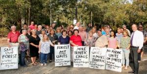
Once it became known all the local community groups formed a coalition called Forest in Danger to oppose the prospect of this magnificent bushland being covered in high rise apartments. In fact the immediate medium density development will also destroy high quality vegetation. There are several other reasons for rejecting the plans that are listed below.
The basic problem is that the reports from Mirvac and council focused on the development site. There was very little information on the rest of the site and therefore no consideration of fundamental issues with the potential loss of biodiversity.
Not only that, the Department of Planning provided a rezoning review briefing report on the site. It noted that A Plan for Growing Sydney does not identify this land for residential purposes and there is no alternative strategy endorsed by council regarding the site’s future use. So, on top of the issues with loss of the forest there is no justification for the rezoning consistent with a strategic plan for additional housing, employment, retail or other business development and transport infrastructure. Traffic on nearby Castle Hill Road is already severely congested. The claims of proximity to Cherrybrook Metro Station are questionable as the walk is more than the desirable criterion of 800 m from the northern part of the site but more like 2 km from the southern part up a steep hill.
The R4 zoning is proposed for the southern area even though no proper assessment has been made of bushfire management, stormwater and flood prone land on top of the loss of biodiversity. Once the zoning is changed the whole forest would be in danger of destruction.
Gateway Determination
Lots of letters of objection have been sent to the Department of Planning and the Hills Council. The Gateway Determination was made on 31 October. The Department of Planning advised council to give proper consideration to appropriate zoning including environmental zones.
One concern with the determination is the suggestion that there could be an area allocated as a forestry zone. The strange aspect of the determination is that the department is allowing council to conduct consultation with the community on an amended plan before the department has reviewed it. Surely the department should consider the new allocation of zoning in light of the overall strategy for north west development so the community has certainty.
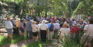
Another community forum was held on 18 November in Cherrybrook. Over 250 people attended and heard a detailed description of the flawed process undertaken so far and of what would be lost if the current zoning were to go ahead. The rezoning plan is opposed by several new councillors on council including the mayor and nearby Hornsby Council.
Summary of Arguments against the Proposal
STEP is strongly opposed to any loss of Blue Gum High Forest (critically endangered) and Sydney Turpentine Ironbark Forest (endangered) no matter how small, as these tiny incremental losses will inevitably lead to their extinction in the long term. This applies to the potential loss in the medium density development area as well as the large areas of these forests in the southern forested areas where the R4 zoning is proposed.
Current Proposal for Medium Density Housing (First Part of the Development)
Asset Protection Zones
The proposed asset protection zone around the development area impacts 0.18 ha of Blue Gum High Forest up to 71 years old, and 0.5 ha of Blue Gum High Forest and Sydney Turpentine Ironbark Forest natural remnant bushland. The NSW Rural Fire Service discourages development in bush fire affected areas that would incur significant environmental costs. There are significant environmental constraints here which are not overcome in this proposal.
Impact of Internal Roads
Currently planned internal roads impact Blue Gum High Forest with a loss of 300 m2 proposed.
Powerful Owl
The impact on Powerful Owl residents would be substantial. These owls need not just peaceful nesting trees and roosting habitat but large areas of trees in which to hunt. Substantial numbers of trees 25 to 30 years old would be cleared for this development and hence reduce hunting opportunities and the probability of owl survival.
Fragmentation of the Forests
The Cumberland State Forest and 55 Coonara Avenue currently form an area of over 60 ha of bushland from the ridge, down to gully habitat. The development and asset protection zone reduce the area of trees and forests and the asset protection zone increases the separation of this site from the Cumberland State Forest. This fragmentation reduces the value of this comparatively large area of remaining Sydney Turpentine Ironbark Forest.
Recommendations
We recommend that the application is rejected in its entirety due to its impact on the environment, particularly Blue Gum High Forest, Sydney Turpentine Ironbark Forest and Powerful Owls. Any possible future development must not have any impact on these endangered communities species and Powerful Owls.
The bulk of this land should at the very least be rezoned to E2 for environmental conservation. Ideally the site should be added to the adjacent Cumberland State Forest and conserved in perpetuity.
More Information
For the latest information on the campaign against the development and more detail on issues with the proposal go to www.forestindanger.org.au.
Email or write to:
- Minister for Planning, Anthony Roberts This email address is being protected from spambots. You need JavaScript enabled to view it.
- Member for Bauklham Hills, David Elliot This email address is being protected from spambots. You need JavaScript enabled to view it.
- Director Sydney West Planning This email address is being protected from spambots. You need JavaScript enabled to view it.
- Hill Shire Council Mayor Michelle Byrne This email address is being protected from spambots. You need JavaScript enabled to view it.
Byles Creek Decision
The tremendous efforts of the local community have produced some beneficial outcomes.
Issue 185 of STEP Matters provided an update on the battle by residents of Beecroft and the Beecroft Cheltenham Civic Trust to save bushland from subdivision and development at 79–87 Malton Road. This bushland is the last remaining corridor along Byles Creek between Lane Cove National Park and Pennant Hills Park.
The matter was brought before a Land and Environment Court conciliation conference. However it was inevitable, the final court determination approved the sub-division.
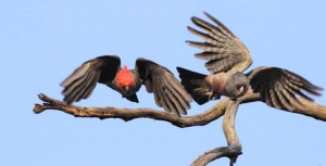
The asset protection zone around the houses to be built will entail the loss of a lot of vegetation but not as much as originally expected. There are conditions requiring the Vegetation and Fauna Management Plans applicable to the asset protection zone to take measures to preserve threatened species such as Leptospernum deanei and a possible nesting site of the Gang-gang Cockatoo. Part of the site (Lot 6 of approximately 1 hectare) will be passed into council hands to be conserved as open space.
A develpoment application for neighbouring land at 77 Malton Road (approx 7000 m2) has also been approved. Unfortunately, 77 trees will be lost for bushfire protection and construction. The owners are prepared to work with council to come to an agreement over the walking track along Byles Creek that will allow the public access to Byles Creek Valley and Lane Cove National Park.
Battle to Preserve the Byles Creek Wildlife Corridor
Beecroft is bearing the brunt of three significant infrastructure developments (North West Rail Link, Epping to Thornleigh Third Track and NorthConnex road tunnel) as well as unit development. These projects have led to the removal of many significant trees including 0.7 hectares of Sydney Turpentine Ironbark Forest which is listed as endangered.
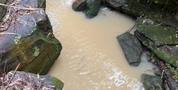
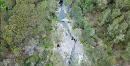
The residents of Malton Road and the Beecroft-Cheltenham Civic Trust have been fighting for many years to save bushland at 79–87 Malton Road from subdivision. If the subdivision application is approved the last remaining corridor of bushland along Byles Creek between Lane Cove National Park and Pennant Hills Park will be lost. It is one branch of Byles Creek that is largely unaffected by urban runoff and it is rare to find such pristine water in urban areas.
The land is in excellent condition, holding high biodiversity values as recognised by its inclusion on Hornsby Shire Council’s Biodiversity Map, with habitat supporting a range of threatened flora and fauna species including Leptospermum deanei, Genoplesium baueri, the grey-headed flying-fox, Powerful Owls and an endangered population of Gang-gang Cockatoos of ‘significant conservation value as it is the last known breeding population of the species in the Sydney metropolitan area’.
If the land is built on, the bushfire regulations will require most of the blocks to be cleared to create asset protection zones. It is unclear whether all six blocks could be built on in any case because of access and asset protection issues. So it could be that most of the area of bushland would be cleared for construction of only two or three houses.
At the June 2015 Hornsby Council meeting following extensive resident addresses and debate, councillors voted unanimously to make a full and comprehensive submission to the NSW Government to acquire this bushland as regional open space. Members of the Byles Creek Valley Union and Civic Trust members worked hard to compile a comprehensive submission to the NSW Government, to augment that prepared by council.
In December the deferred application was refused by council on the grounds that the ecological assessments provided by the applicant were inadequate. Precise confirmation is needed of the possible presence of two plant species: the vulnerable Leptospermum deanei and the endangered Genoplesium baueri, an orchid. It would not be known until March – when the orchid flowers – whether it grows on the site.
The applicant has not been prepared to obtain extra information about this orchid and the applicant then appealed the decision before the Land and Environment Court.
A report commissioned by council by ecological consultant Peter Smith stated the entire site:
… is worthy of purchase and management as a bushland reserve ...
If funding is not available to purchase the land, then further assessment is needed of the impact of the proposed subdivision and residential development of this land …
A patch of bushland like this, with so many large, old trees, forms a crucial piece of habitat for so much of our biodiversity and its loss would be a loss for the community and Sydney as a whole …
He also questioned whether offsets are available in respect of the land to be cleared.
On 10 March a conciliation conference was held on site. Over 100 local residents arrived on a very steamy morning to hear very detailed oral submissions from four local residents explaining their reasons for opposing the application.
Further negotiations are going on via the Land and Environment Court conciliation process. This is due to be finalised on 6 May.
The residents are still fighting with all their might. They are pushing for the proceeds from the council sale of a church hall in Cheltenham to go towards purchasing the land. See www.2119.org.au for the full story. The group has also created a Facebook page for Mikey the Powerful Owl that is frequently seen in the valley.
Please write to the Hornsby councillors to express support for acquiring the land so this precious bushland can be preserved.

